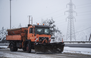
The locally heavy showers and thunderstorms, snowfall on the continents even at low altitudes and gusty winds will continue today with decreasing intensity from the evening hours. Further weakening of the phenomena is expected tomorrow, but frost will persist until Friday (17/1), mainly in central and northern Greece, which will be strong in some places in the northwest.
According to the update of the National Meteorological Service’s Weather Emergency Bulletin:
Heavy rain is forecast in the southern Ionian Sea, the Peloponnese (mainly the western and southern parts), Central Greece, Thessaly (mainly the eastern parts), the Sporades, Evia, the Cyclades and from midday onwards in the northern and eastern Aegean islands and the Dodecanese. Sporadic thunderstorms will mainly occur in the southern maritime and coastal areas.
Snowfall in Epirus, Macedonia and Thrace will continue in mountainous – semi-mountainous areas and in some places in areas with lower altitude, but will weaken in the evening.
In Thessaly, Central Greece and the Peloponnese snowfall will be locally dense in mountainous – semi-mountainous areas, as well as in areas of Thessaly and Central Greece (Fthiotida, Boeotia) with lower altitude, with decreasing intensity from the evening hours.
In the Aegean Sea, gusty northeast winds of 8 and in the north 9 Beaufort will blow. In the Ionian Sea gusty easterly winds of 7 to 8 Beaufort will blow. Gradual weakening is expected from the afternoon hours.
It should be noted that frost will persist until Friday (17-01-2025), mainly in central and northern Greece, which will be strong in places in the northwest.
Ask me anything
Explore related questions


