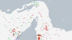
Unsteady weather conditions will persist until Friday, with localized showers mainly in the Ionian, Epirus, and Western Greece, gradually spreading to Thessaly, Macedonia, and Thrace, according to the Hellenic National Meteorological Service (HNMS).
Midweek Forecast
- Wednesday: Scattered showers in the Ionian, Epirus, and Western Greece, later expanding to Thessaly, Macedonia, and Thrace. Isolated thunderstorms are expected in the northwest.
- Thursday: Rain in western Greece, the eastern Aegean islands, the Dodecanese, and southern coastal areas, spreading gradually across the country. Thunderstorms will develop in the Ionian and eastern and southern regions.
- Friday: Partial cloud cover with localized showers in the east and south, gradually improving. In other regions, occasional cloud cover will clear by midday.
By Saturday, clear skies will prevail, but by Sunday afternoon, rain and thunderstorms will move in from the west.
Spring-like Weather Shift with Dust and Muddy Rain
Meteorologist Giorgos Tsatrafilias (Alpha TV) highlights an upcoming shift in weather conditions:
- Thunderstorms on Wednesday in western Greece, intensifying over Corfu and Paxos.
- Thursday: Storms will extend to the eastern Aegean, the Dodecanese, Macedonia (mainly Halkidiki), and Thrace. Light muddy rain is expected across most areas due to increased Saharan dust levels. South winds will reach 6-7 Beaufort over the seas.
Temperatures will remain above seasonal averages, ranging from 15°C in northern Greece to 18-19°C in southern regions. By next week, colder temperatures and snow are expected.
Cold Morning Temperatures Recorded
On Tuesday morning, temperatures dropped to -3.8°C in Karpenisi, specifically at the Karpenisi-Voutyro station. Other low temperatures were recorded in:
- Mavrolithari, Phocis: -3.6°C
- Vovousa, Ioannina: -3.4°C
Below is a summary of the eight coldest temperatures recorded by the automatic weather station network of Meteo.gr / National Observatory of Athens.
Today’s Weather Forecast
Skies will be partly cloudy, gradually becoming overcast. Local showers will initially affect the Ionian, western and northeastern mainland, the Aegean, and Crete. By the afternoon, heavy rainfall, thunderstorms, and hailstorms will develop over the Ionian and western mainland, with high dust concentrations affecting visibility.

Temperature Overview:
- Western Macedonia: 0 to 14°C
- Rest of Macedonia & Thrace: 3 to 16°C
- Thessaly: 3 to 17°C
- Epirus & Western Greece: 7 to 16°C
- Central Greece: 4 to 19°C
- Peloponnese: 2 to 19°C
- Ionian Islands: 13 to 16°C
- Northern & Eastern Aegean: 11 to 16°C
- Cyclades: 7 to 17°C
- Dodecanese: 8 to 17°C
- Crete: 6 to 20°C
Winds:
- Aegean: South 3-5 Beaufort, strengthening to 4-6 in the north.
- Ionian: South to southwest 3-5 Beaufort.
Regional Forecasts
- Athens: Cloudy skies with a chance of rain in the northern areas by evening. Winds shifting from west (3 Beaufort) to south (2-4 Beaufort). Limited visibility in the morning. Temperatures: 9-17°C.
- Thessaloniki: Cloudy with possible rain in the evening. Winds east-southeast 2 Beaufort, increasing to 2-4 Beaufort. Limited visibility in the morning. Temperatures: 8-15°C.
Thursday, January 30, 2025
Heavy cloud cover and rain across the country. Thunderstorms mainly in the Ionian, western mainland, Peloponnese, and later in eastern and southern regions. Intense rainfall may occur in the Dodecanese. Snowfall is expected in the mountains of central and northern Greece.

Winds: South 4-6 Beaufort, shifting to northwest 4-5 Beaufort in the evening.
Temperatures: Slightly cooler in western areas (max 13-15°C), while other regions remain above seasonal norms (16-18°C).
Friday, January 31, 2025
Eastern and southern regions will see scattered showers and isolated morning thunderstorms, mainly in coastal areas, followed by gradual improvement. Elsewhere, brief morning clouds will give way to mostly clear skies. Morning and evening visibility will be low in mainland areas.
Winds:
- West & North: West-northwest 3-4 Beaufort, reaching 5 in the south.
- Elsewhere: Southwest 3-4 Beaufort, shifting to northwest (up to 5 Beaufort) by afternoon.
Temperatures: No significant change.
Saturday, February 1, 2025
Clear skies with occasional cloud cover. Morning and evening visibility may be reduced in mainland areas.
Winds:
- East: North 3-5 Beaufort.
- West: East 3-5 Beaufort, strengthening in the Ionian and later in the northern Aegean.
Temperatures: Slightly warmer, especially in southern regions.
Sunday, February 2, 2025
Cloudy skies nationwide. Rain and scattered thunderstorms will develop in the Ionian, spreading to the mainland by midday. Snowfall is expected in mountainous areas, especially in the evening.
Winds:
- West: Southeast 5-6 Beaufort, weakening slightly at night.
- East: North 3-5 Beaufort, turning south in the afternoon.
Temperatures: A drop is expected in northern areas.
Ask me anything
Explore related questions


