More than 100 drones distributed across all regions of Greece will be available to the Fire Service and Civil Protection during this year’s wildfire season, as part of the country’s forest surveillance mechanism.
According to Civil Protection sources, the drones will play a decisive role in monitoring, the rapid reporting of incidents, and the verification of information. The unmanned aerial vehicles (UAVs) will operate around the clock, providing continuous live coverage of the areas they monitor, and have already been deployed across all 13 administrative regions of the country.
Strategic locations have reportedly been selected to monitor forests, suburban areas, high-risk zones, regions with a history of fires, and locations with difficult access. The drones are equipped with thermal cameras, high-zoom optical cameras, laser range-finder systems, GPS, and telemetry systems.
Recently, Climate Crisis and Civil Protection Minister Evangelos Tournas stressed during the 5th Forum of the Hymettus Protection and Development Association that “we cannot confront natural disasters with tools and mindsets of the past,” emphasizing the need for continuous adaptation of planning and operational readiness to the realities created by the climate crisis.
Tournas also reiterated that the operational doctrine is based on “surveillance, early warning, immediate mobilization of forces, and rapid intervention to contain fires during the first critical minutes,” adding that “the key to effective response is, first, reducing fire outbreaks as much as possible, and second, intervening early.”
Drone distribution by region
The drone allocation across Greece’s regions is as follows:
- Attica: 27 drones
- Central Greece: 7
- Thessaly: 5
- Epirus: 5
- Western Macedonia: 3
- Central Macedonia: 15
- Eastern Macedonia & Thrace: 7
- North Aegean: 4
- South Aegean: 3
- Crete: 4
- Peloponnese: 8
- Western Greece: 7
- Ionian Islands: 5
Mobile drone surveillance units
In addition, this year the Fire Service and Civil Protection will also operate three specially configured mobile drone surveillance units designed to provide immediate operational support in areas where fires break out or where there is heightened risk.
These units will be based in Attica, Thessaloniki, and Crete, but can also be deployed elsewhere depending on operational needs. According to officials, they will include multi-backup communication systems to ensure uninterrupted transmission of visual data to operation centers, multi-screen control consoles for complete oversight, and advanced processing units providing crews with access to critical real-time information.
These mobile centers will be able to relocate immediately wherever needed, with drones conducting continuous surveillance flights and transmitting live video and data in real time.
How the drones operate
The drones monitor forests and other high-risk areas both day and night. During nighttime operations, they use thermal imaging cameras, allowing operators to detect heat signatures even in low-visibility conditions.
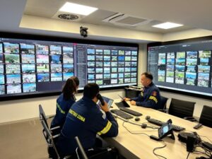
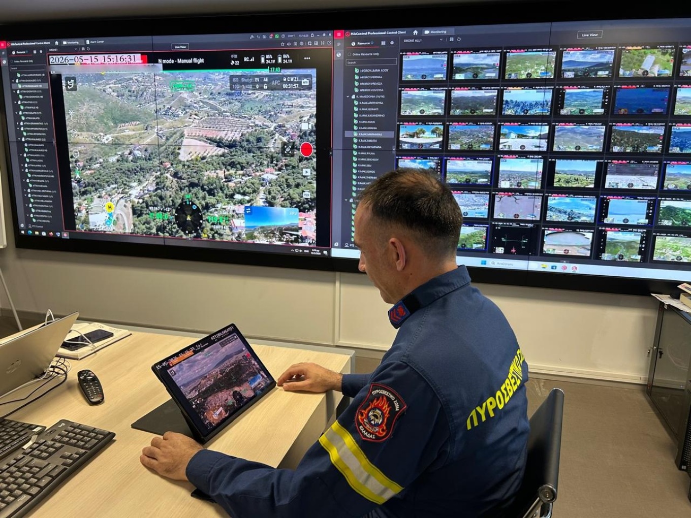
According to Civil Protection sources, this enables the early detection of heat sources, suspicious smoke, or fire activity even in inaccessible areas. Live footage is transmitted in real time to Regional Operations Centers and to the National Coordination Center for Operations and Crisis Management, while frontline operational teams can also receive the same feed on tablets and smartphones.
When a fire breaks out, drones help identify the source rapidly — even during the earliest moments of ignition. Officials say they are also crucial in directing firefighting forces, since they provide a continuous live overview of the fire front.
Authorities stress that this capability is extremely important because it allows for immediate operational awareness and faster real-time decision-making. Field commanders receive the same live operational picture on mobile devices, giving them a broader understanding of the fire rather than just the area immediately around them. This allows them to quickly adapt deployment plans according to changing conditions.
Artificial intelligence and “panic button” alerts
The drones are built for high endurance and combine thermal and optical sensors with advanced artificial intelligence algorithms. According to Civil Protection sources, this creates “an uninterrupted surveillance mechanism” capable of visually confirming incidents from long distances, identifying terrain details such as vegetation type and road access, detecting thermal anomalies before they are visible to the naked eye, and monitoring fire evolution in low-visibility, smoke-heavy environments.
Using AI software, the system can also calculate the exact geographic coordinates of an incident in real time.
Drone operators continuously scan their assigned areas. If they detect heat or smoke, they use thermal and optical zoom to focus on the point of interest and immediately alert the Fire Service with the precise geographic coordinates of the incident.
Additionally, the system incorporates a rapid-alert “Panic Button” feature. Once a drone operator detects a fire source, activating the button automatically reorganizes the video wall inside the operations center, enlarging the live drone feed in a pop-up window for immediate attention.
At the same time, the Fire Service can use the live aerial footage to rapidly assess the severity of an incident even before firefighting units arrive, helping prioritize the deployment of both ground and aerial resources.
Finally, officials note that the use of drones in wildfire response has expanded significantly in recent years. In 2024, Greece used 40 drones in its first year of large-scale operational deployment, while in 2025 the number increased to 80.
Ask me anything
Explore related questions


