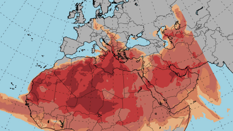
Increased concentrations of African dust will be increased in the coming days in our country, while according to the National Meteorological Service (EMY), a gradual rise in temperature is expected.
Specifically, for tomorrow, Saturday, the weather will be generally clear in the north, but will gradually develop thin clouds that from noon in the south will thicken and local rainfall will occur mainly in the Peloponnese and western Central Greece.
Watch the video of Meteo’s maps showing the path of the African dust until Tuesday:
Meteo forecast: the dust path
Meteorologists are forecasting a “cocktail” of high temperatures and African dust due to a subtropical air storm that has approached Greece. Indicatively in many areas the temperature will reach 30 to 32 degrees.
Locally in the south and Crete it is possible to reach 34 to 36 degrees, accompanied by southerly winds. Dust will have a strong and persistent presence in the country’s atmosphere, contributing to the feeling of discomfort.
The intense phenomena will move mainly between Crete and the Peloponnese, while gradually shifting further east. At noon, African dust is expected across the country, mainly in the west and south, while in the evening the dust will shift to the central Aegean.
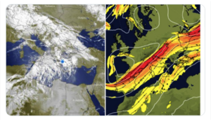
The phenomena are mobilised by the air tide which, according to Theodore Kolydas in an earlier explanation, “are created by a combination of atmospheric heating and the rotation of the planet around its axis. This upper atmospheric flow, and the almost gusty southerly winds blowing in the West will cause a transport of African dust, but also high temperatures in our region until early next week”.
Thodoros Kolydas explains the phenomenon of the airborne phenomenon
1.The #aerohermaros is the main driver of the weather systems that move according to its flow.We liken it to the train tracks, on which the …weather cars move.
2. In this case, warm masses and dust are being transported, but there is also cloud cover, which plays an inhibiting role in the rise in temperature (for the time being). We had reported on this in the previous days but not all the public got this information
3. Many times between two axes of the #jetstream (as seen in the image), unsettled weather is developing. This weather will mainly affect the north by Monday, as we reported in a previous post.

The first shipment of humanitarian aid arrived in Gaza through US floating pier
In detail the weather on Saturday, according to EMY:
Initially generally clear weather in the north, but gradually thin clouds will develop, which will become thicker from noon in the south and local rain or rain will occur mainly in the Peloponnese and western Central Greece. Visibility in the morning hours on the mainland will be locally limited. Concentrations of African dust will remain elevated mainly in the west and south of the country.
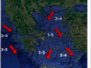
Winds will be variable, light, in the Ionian Sea will blow east southeast 3 to 5 Beaufort and in the Aegean Sea north northwest with the same intensity. The temperature will rise slightly, mainly in the north. It will reach 27 to 31 degrees Celsius on the mainland, 24 to 27 degrees Celsius on the islands and locally 31 degrees Celsius in Crete.
Ask me anything
Explore related questions


