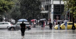
Severe weather instability is expected to continue across much of the country on Saturday, August 31st. The National Weather Service has updated the Special Weather Circular, initially issued on August 29th, 2024, at noon.
Cold and unstable air masses in the upper atmosphere will remain over our country until today (31-08-24), affecting in places most of the mainland with heavy rain and thunderstorms, accompanied by a high frequency of lightning and local hailstorms. Occasionally, the phenomena will be accompanied by very strong winds (bourines).
Alternatives
Locally heavy rain and thunderstorms are forecast today Saturday (31-08-24):
1. From the early morning hours and until late afternoon in the Sporades, Evia and possibly Thessaly.2. During the midday and afternoon hours in the Peloponnese, Sterea (including Attica) and in places in Epirus and Macedonia (mainly central and eastern).
According to the director of the National Meteorological Service, Thodoros Kolydas, the phenomena are expected to occur in the midday hours and as he stressed: “today’s data show that tomorrow the storm may be more intense in Attica, from 1 pm to 5-6 pm, that is, we will have a longer duration.”
The focus of the phenomena will be the Central region of Central Greece and the central and eastern Peloponnese, he added.
An improvement is expected in the evening hours in most areas.
Midday showers and storms in Attica from Penteli cameras
Cameras at the National Observatory’s facilities in Penteli recorded the development of the phenomena over Attica yesterday. The video below, which runs from 09:00 to 18:00, shows the rain and thunderstorms that occurred at noon on Friday (30/8).
More than 50 calls to the fire department
As it was known by the Fire Department, for Attica, the Fire Department’s Operations Center received at least 40 calls yesterday, which mainly involved water pumping, tree cutting and transfers of people to safe places. Furthermore, the PS Operations Center received 14 calls for extricating people from elevators, mainly in the southern suburbs of Attica.
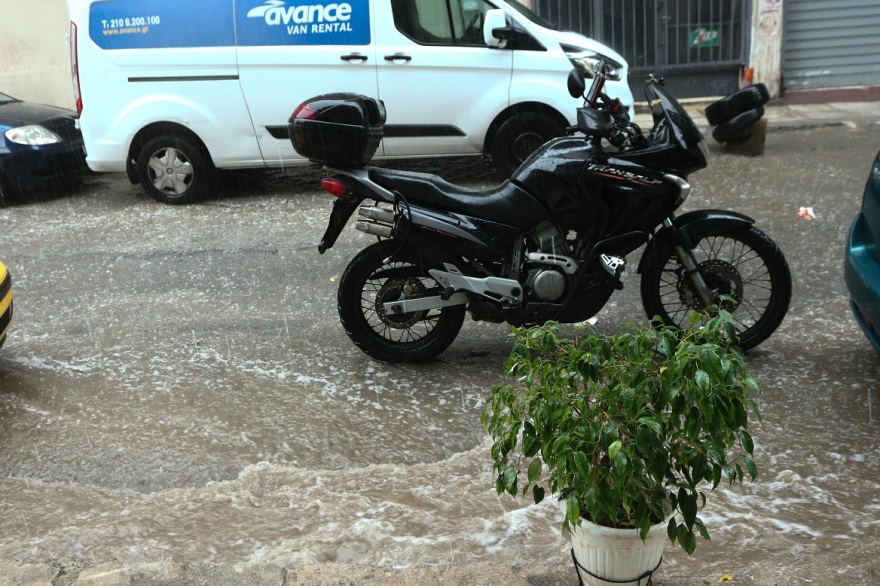
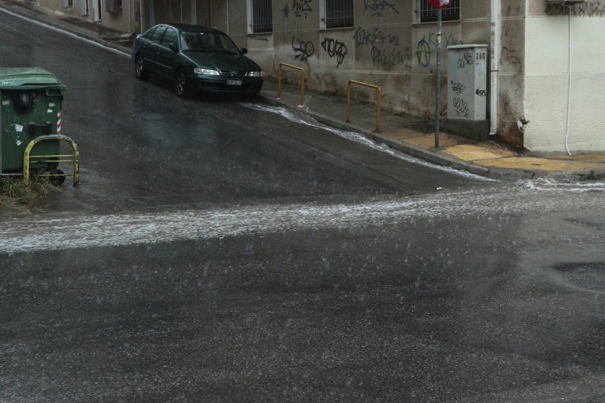
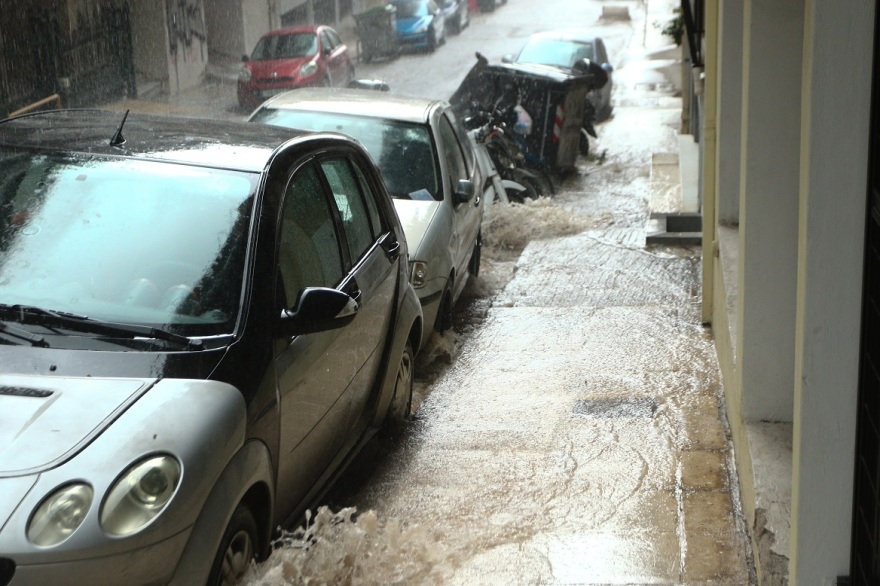
Vrilissia, Patissia, and Maroussi have the highest rainfall in Attica
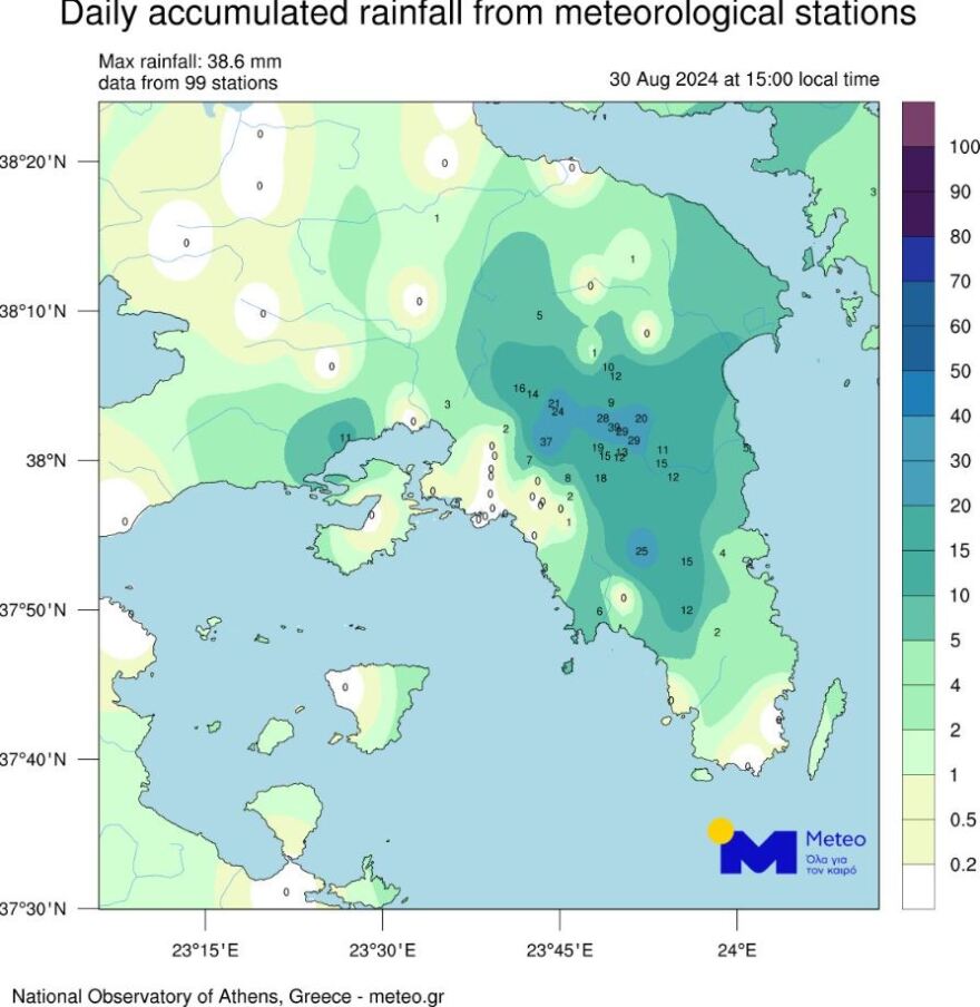
Significant rainfall was recorded in Athens on Friday (30/8) afternoon. The map below gives the total rainfall up to 15.00 in Attica, as produced by the measurements of 70 stations of the meteo.gr network of the National Observatory of Athens.
According to the Director of Research of the National Observatory of Athens, Kostas Lagovardos, the highest rainfall levels were recorded in the center and north of the basin, with 39 millimeters in Vrilissia, 37 millimeters in Patissia, 29 millimeters in Maroussi and 24 millimeters in Metamorfosi.
Car crashed into a hole in St. Eleftherios
The front end of a private car fell into a large hole during the bad weather that hit Attica, in the area of Agios Eleftherios, near the Ano Patissia train station.
On the road, according to reports, there was an accumulation of water, resulting in the hole not being visible to drivers. The driver of the vehicle was slightly injured in the neck and was offered first aid. The incident occurred on Halkidos Street.
Euboea
Intense weather was also experienced in areas of Evia yesterday afternoon. According to e-vima, roads were turned into a river by the intense storm that “hit” areas of central and southern Evia.
.
Crete
As well as in the regions of Messara, Agia Varvara, Lagou, but also Lasithi, Dermata, Kritsa, and elsewhere. There was strong thunder in the city of Heraklion.
Trikala
Heavy thunderstorms and rainfall also hit the Trikala area, extending from the mountains to the city center.
The rainfall was accompanied by strong winds, lightning activity, and weak hail.
Shortly after 17:50, 112 sent a warning message to the residents of the Municipality of Trikkaion, urging them to limit their movements and follow the instructions of the authorities due to the heavy hail.
⚠️ Enable 1⃣1⃣2⃣
? Due to heavy hail in the #Trikkia please limit travel in the area
‼️ Follow the instructions of the authorities
ℹ️ https://t.co/mbLpAekY6l@pyrosvestiki@hellenicpolice
– 112 Greece (@112Greece) August 30, 2024</blockquote
The weather today
At first, local showers and occasional thunderstorms are expected, mainly on the mainland. Gradually the phenomena will intensify and will extend to the Ionian Sea, the North Aegean and Crete. Scattered showers will also occur in the Central and Southern Aegean. There is a possibility of hail mainly for the mountainous continental areas. Dust concentrations in the atmosphere will be relatively increased mainly in the northeast.
The temperature in Western Macedonia will range from 16 to 28 degrees Celsius, in the rest of Macedonia and Thrace from 20 to 32, in Thessaly from 21 to 33, in Epirus and Western Central Greece from 19 to 33, in the rest of Central Greece from 21 to 32, in the Peloponnese from 18 to 32, in the Ionian islands from 21 to 31, in the North and East Aegean islands from 20 to 31, in the Cyclades and the Dodecanese from 21 to 31 and in Crete from 21 to 32 degrees Celsius.
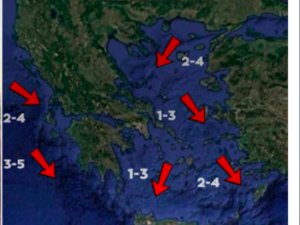
Winds in the Central and North Aegean Sea will blow from northwest to north directions from 2 to 4 Beaufort. In the South Aegean, the winds will blow from westerly to northerly directions 3 to 5 Beaufort. In the Ionian Sea, the winds will initially blow from variable directions from 2 to 4 Beaufort but from noon onwards they will become north-westerly of the same intensity.
MACEDONIA, THRACE
Weather. The phenomena in the midday and afternoon hours will be locally strong mainly in central and eastern Macedonia. Improvement in the evening hours.
Winds: From northern directions 3 to 4 and in the east locally 5 Beaufort.
Temperature: From 18 to 30 degrees Celsius. In western Macedonia 2 to 3 degrees lower.
From 18 to 18 degrees Celsius and below, with a slight decrease in temperature to 18.2 degrees Celsius.
Ionian ISLAND, HEPIROS, WESTERN STREET, WESTERN PELOPONESOS
Weather. The phenomena in the midday and afternoon hours will be strong in western Sterea, western Peloponnese, and occasionally in Epirus. Improvement, except in the southern Ionian Sea, in the evening hours.
Winds: Variable 3 to 4 Beaufort and in the Ionian Sea from the north with the same intensity.
Temperature: From 20 to 32 degrees Celsius. In the interior of Epirus 2 to 3 degrees lower.
From 20 to 20 degrees Celsius, with temperatures between 20 and 20 degrees Celsius.
Eastern Sterea, Evia, Eastern Peloponnese
Weather: in Evia, clouds, partly cloudy with local rain and occasional strong thunderstorms. In the rest of the regions a few clouds, partly cloudy and partly cloudy with local showers, and in the midday and afternoon hours occasional strong thunderstorms. Improvement in the evening hours.
Winds: Variable 3 to 4 Beaufort and gradually in the east-north northeast with the same intensity.
Temperature: From 20 to 32 degrees Celsius.
From 20 to 20 degrees Celsius.
CRETE
Weather. In Crete, a few clouds, partly cloudy and partly cloudy with local rain, and mainly in the midday and afternoon hours isolated thunderstorms mainly in the mountains.
In Crete, there a few clouds, partly cloudy and partly cloudy with local rain, mainly in the afternoon and afternoon hours isolated thunderstorms mainly in the mountains.
Winds: Northwestern 3 to 5 and in the east partly locally 6 Beaufort.
Temperature: From 22 to 30 and in southern Crete up to 32 degrees Celsius.
From 22 to 22°C and from 22 to 30°C and from 22 to 32°C.
ISLANDS OF EAST AEGEAN – DODECANESE
Weather. In the islands of the eastern Aegean a few clouds, partly cloudy in the midday and afternoon hours, where local rain or isolated thunderstorms are possible.Winds: North northwestern 4 to 5 locally 6 Beaufort.
Temperature: From 22 to 32 degrees Celsius.
From 22°C to 22 °C.
THESSALY
Weather. Improvement in the evening hours in Thessaly.
Winds: Variable 3 to 4 Beaufort and gradually in the east north-northwest with the same intensity.
Temperature: From 19 to 33 degrees Celsius and in the Sporades up to 29 degrees Celsius.
From 19 to 19 degrees Celsius and 29 degrees Celsius.
ATTICA
Winds: Variable 3 to 4 Beaufort and gradually north-northeast with the same intensity.
Temperature: From 22 to 30 degrees Celsius.
From 22 to 22 degrees Celsius.
THESSALONIKI
Weather. Improvement in the evening hours.
Improvement in the evening hours.
Winds: Variable 3 to 4 Beaufort.
Temperature: From 19 to 29 degrees Celsius.
SUNDAY 01-09-2024
In the Sporades, Evia, and the eastern parts of Thessaly, initially unstable weather with showers and occasional thunderstorms with gradual improvement. In the morning hours in the southern Ionian Sea, southern Peloponnese, Cyclades and Crete, clouds, partly cloudy with local showers or rain. In the rest of the country the weather will initially be almost clear with local clouds in central, eastern Macedonia and Thrace, but in the midday – afternoon hours clouds will increase in the mainland, where local rain or rain and possible isolated thunderstorms will occur, mainly in the central and southern mountains.
In the morning and evening hours, mainly in the western continents, visibility is likely to be locally limited.
Winds will blow from northern directions 3 to 4 Beaufort and in the Aegean Sea 4 to 5, locally 6 Beaufort.
The temperature will rise slightly in the west and north and will reach 30 to 32 and locally 33 degrees Celsius in the mainland, the Ionian Sea, the Dodecanese, and Crete 27 to 30 degrees Celsius in the rest of the island country.
Recommendations from the Civil Protection
The General Secretariat of Civil Protection (civilprotection.gov.gr) of the Ministry of Climate Crisis & Civil Protection, has informed the relevant government departments involved, as well as the regions and municipalities of the country, to increase civil protection preparedness, to deal immediately with the effects of the outbreak of severe weather.
In particular, in areas where heavy rainfall, thunderstorms, or gusty winds are forecast, the GIS recommends that citizens:
– Secure items that may cause damage or injury if carried away by severe weather.- To ensure that the gutters and downspouts of houses are not blocked and are functioning properly.
– Avoid crossing streams and creeks, on foot or by vehicle, during storms and rainstorms and for several hours after they have ended
– Avoid outdoor work and activities in marine and coastal areas during the onset of severe weather events (risk of lightning strikes).
– Take shelter immediately during a hailstorm. Take shelter in a building or car and do not leave the safe area until they are sure the storm has passed. Hail can be very dangerous for animals as well.
– Avoid crossing under large trees, under posted signs, and generally from areas where light objects (e.g., pots, broken glass, etc.) can become detached and fall to the ground (e.g., under balconies).
– Follow strictly the instructions of the local authorities, such as traffic police.
In areas where there is intense lightning activity:
If you are at home
– Do not hold electrical appliances or the telephone because lightning can pass through wires. Disconnect television sets from the antenna and power supply.
– Avoid touching plumbing pipes (kitchen, bathroom) as they make good conductors of electricity..
If you are in the car
– Park it on the side of the road and away from trees that may fall on it.
– Stay inside and turn on the warning stop lights (emergency lights) until the storm subsides.- Close windows and do not lean against metal objects.
– Avoid flooded streets.
If you are outdoors
– Take shelter in a building or car otherwise immediately sit on the ground without lying down.
– Take shelter under solid branches of low trees in case you are in a forest.
– Never shelter under a tall tree in an open area.
– Avoid lowlands for the risk of flooding.
– Do not stand next to power lines, telephone lines, and fences.
– Do not approach metal objects (e.g., cars, bicycles, camping equipment, etc.).
– Stay away from rivers, lakes, or other bodies of water.
– If you are in the water get out immediately.
– If you are isolated on a flat area and feel your hair stand up (indicating that lightning will soon occur), sit deep with your head between your legs (to minimize your body surface area and contact with the ground) by throwing any metal objects you have on you.
Ask me anything
Explore related questions
