
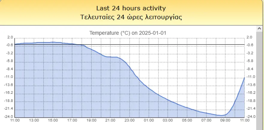
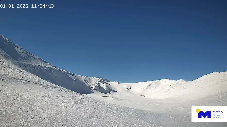
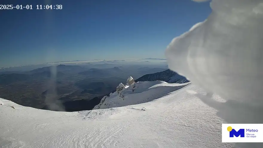
With an admittedly impressive temperature difference, 2025 kicked off as, according to data from the National Observatory of Athens, while in Chania the thermometers showed 19 degrees Celsius, in Sessi Parnassos they showed -23 degrees Celsius.
The observation about the temperature difference was pointed out in a Facebook post by Alpha meteorologist George Tsatrafillas, meteo.gr has published photos of the snowy landscape where the Parnassos station is located, as well as the temperature chart of the last 24 hours.
The weather forecast through Monday
Generally clear weather with a few clouds gradually increasing in the west, south, and the eastern Aegean islands with passing showers mainly in the west. Visibility in the morning and evening hours will be locally limited and fog will form. Winds will be variable from 2 to 4 and in the Aegean Sea will blow southwest up to 5 Beaufort. The temperature will not change significantly and will reach 14 degrees Celsius in the north, 15 to 17 degrees Celsius in the rest of the regions, and 18 degrees Celsius locally in Crete and the Dodecanese. In the northwestern continental areas in the morning hours, there will be frost in places.
On Friday, a few clouds, mostly in the west and the eastern and southern Aegean Sea, where there will be some localized rainfall, but the phenomena will intensify in the evening hours. Visibility in the morning hours will be locally limited. Winds will be south-southwest 3 to 4 Beaufort, in the Ionian Sea up to 5, and in the Aegean Sea 5 to 6 Beaufort. The temperature will not change significantly and will reach 14 degrees Celsius in the north, 15 to 17 degrees Celsius in the rest of the regions, and 18 degrees Celsius locally in the southern Aegean. In the northwestern mainland in the morning hours, there will be frost in places.
On Saturday, clouds are forecast throughout the country, partly cloudy with local rain. Isolated thunderstorms will occur in the west and the eastern Aegean. The phenomena will stop at night in the west and north. Winds will blow from southerly directions 3 to 4 and in the Aegean Sea locally up to 5 Beaufort. But quickly in the west and north and gradually in the rest of the regions, they will turn to northerly directions and in the northeastern Aegean they will increase to 5 to 6 Beaufort. The temperature will drop in the north with maximum values.
On Sunday in the eastern and southern Aegean clouds are forecasted, partly cloudy with local rain and occasional thunderstorms and gradual improvement. In the rest of the country a few clouds, partly cloudy with local showers until the afternoon, mainly in the Sporades and Evia. Visibility in the morning and evening hours will be locally limited and fog will form. Winds will blow from north directions 3 to 5 and in the Aegean Sea, locally 6 Beaufort and only in the southeast in the early morning hours will be east southeast up to 5 Beaufort. The temperature will drop slightly.
On Monday the weather will be almost clear with a few local clouds. Visibility in the morning and evening hours will be locally limited and fog will form. Winds will initially blow from the north from 3 to 5 and in the southeastern Aegean Sea in the morning hours up to 6 Beaufort, but will gradually shift to west southwest up to 5 Beaufort. The temperature will not change significantly.
Ask me anything
Explore related questions


