
After an Exceptionally Warm January, Cold Air Masses Affect Southern Balkans and Greece
Although this weather development is typical for the season, an unusually strong anticyclone in Northeastern Europe will keep cold conditions in Greece until mid-month.
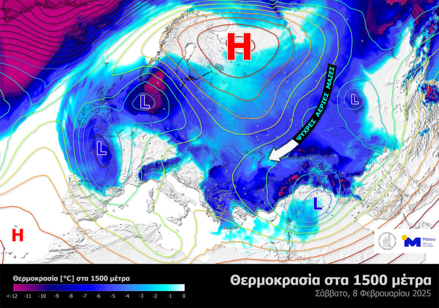
The map illustrates:
- Atmospheric pressure at sea level, highlighting the center of the strong, cold anticyclone over Western Russia.
- The distribution of cold air masses surrounding the anticyclone.
- The movement of cold air masses towards Greece.
This situation arises from the westward expansion of the Siberian Anticyclone, combined with high pressure over Scandinavia, which has developed due to intense low-pressure activity in the North Atlantic Ocean.
In short, atmospheric circulation in the Northern Hemisphere will sustain cold conditions in Greece for several days. Temperatures will be approximately 5-7°C lower than the seasonal average.
It is worth noting that the 1500-meter altitude level is commonly used in meteorology to study the movement of air masses.
Ask me anything
Explore related questions


