
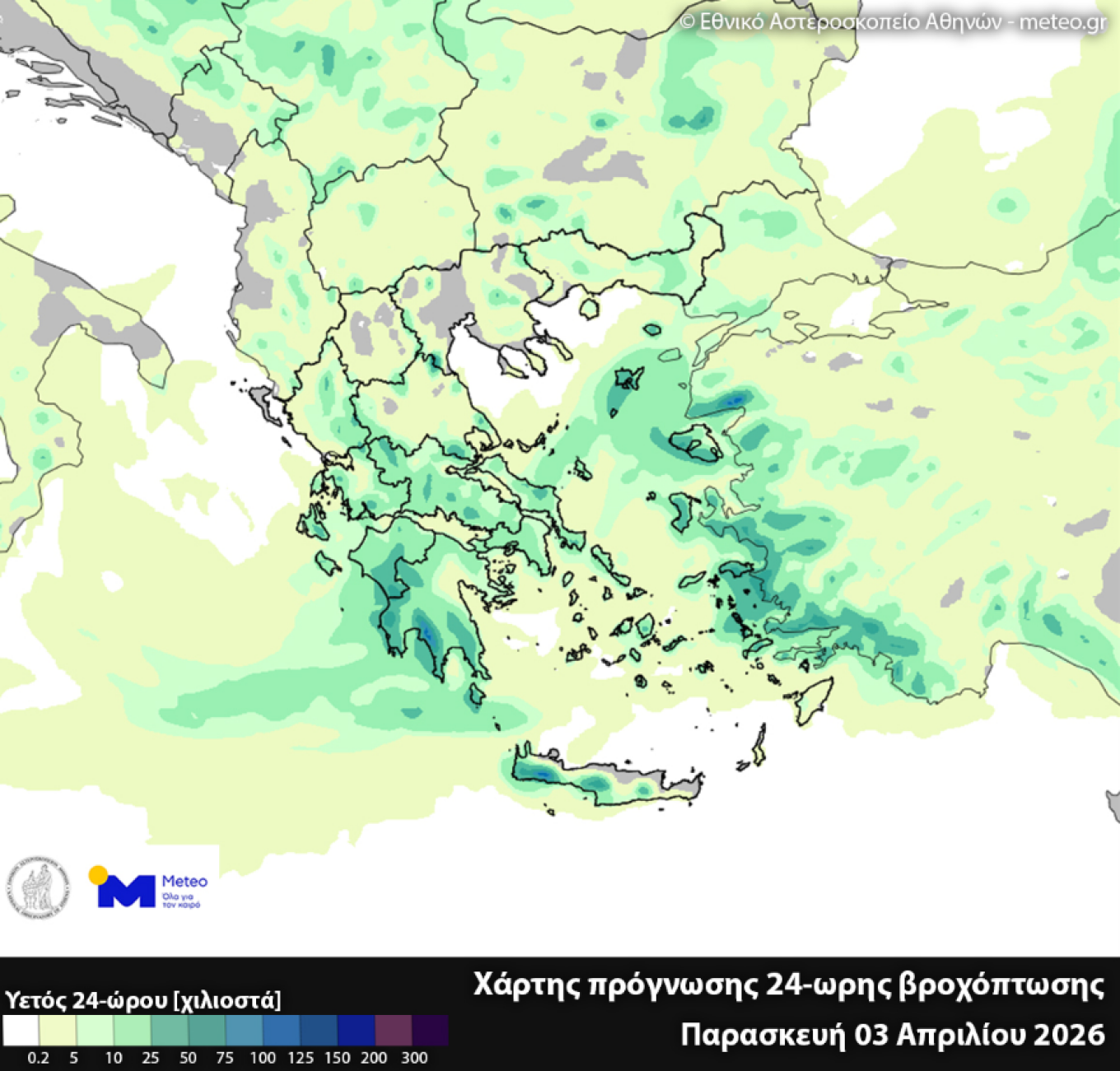
Rain and local thunderstorms are expected on Friday, 3 April 2026, in many parts of the country, according to forecast data from the National Observatory of Athens / meteo.gr, as shown on the 24-hour cumulative rainfall map for 03/04/2026.
The highest rainfall levels are expected in Western Greece, the Peloponnese, the Cyclades, Crete, and parts of the eastern Aegean, while significant rainfall is also expected in several mainland areas.
In some locations, the phenomena may be intense, mainly in the southern and eastern parts of the country.
On Saturday, the phenomena will persist mainly in the south and the eastern Aegean, while in the rest of the country the weather will remain unsettled with local rain and thunderstorms, mainly in the afternoon. Winds will gradually turn northwesterly and weaken.
On Sunday, further improvement is expected, with northerly winds prevailing and phenomena becoming more limited, although local rain will still occur mainly in eastern and southern areas, as well as afternoon instability in the mainland.
Weather forecast for Holy Week
From Holy Monday, the weather will show a noticeable improvement, with more sunshine, limited phenomena mainly in the south, and a gradual rise in temperature, in a clearly spring-like setting.
According to meteorologist Sakis Arnaoutoglou, the weather during Holy Week will be spring-like. From Holy Monday to Holy Thursday the weather will be good. From Holy Saturday onwards – according to the latest data – low-pressure systems will approach the country and change the weather, bringing rain and storms in western, central and northern Greece.
He concludes that the weather will likely remain good possibly until Good Friday, but may deteriorate from Easter Sunday.
WEATHER UNTIL EASTER
FORECAST FOR PALM SUNDAY (05-04-2026)
In Thessaly, the Sporades, eastern Central Greece, Evia, western and southern parts of the Peloponnese and the southern island regions, cloudiness with local rain and isolated thunderstorms, gradually improving from the northern mainland in the afternoon. In the rest of the country, scattered clouds which will increase during midday and afternoon over mainland areas, with local rain or showers and possibly isolated storms. Winds from northern directions, 3–5 Beaufort in the west and 4–6 in the east. Temperatures will slightly rise, mainly in the west.
FORECAST FOR HOLY MONDAY (06-04-2026)
In the Cyclades, Crete and possibly the Dodecanese, cloudiness with local rain and isolated thunderstorms, with quick improvement mainly in the Cyclades. In the rest of the country, scattered clouds increasing in the afternoon over mainland areas, with local rain or showers mainly in the west. Winds from northern directions, 3–5 Beaufort in the west, 4–5 in the east, and in the Aegean 6 and locally up to 7 Beaufort. Temperatures will rise slightly further, mainly in western and northern areas.
FORECAST FOR HOLY TUESDAY (07-04-2026)
In the Dodecanese and Crete, scattered clouds at times increasing with local rain and possibly isolated thunderstorms. In the rest of the country, generally clear weather with temporary clouds during midday and afternoon over mainland areas. Winds from northern directions, 3–5 Beaufort. Temperatures will rise.
Ask me anything
Explore related questions


