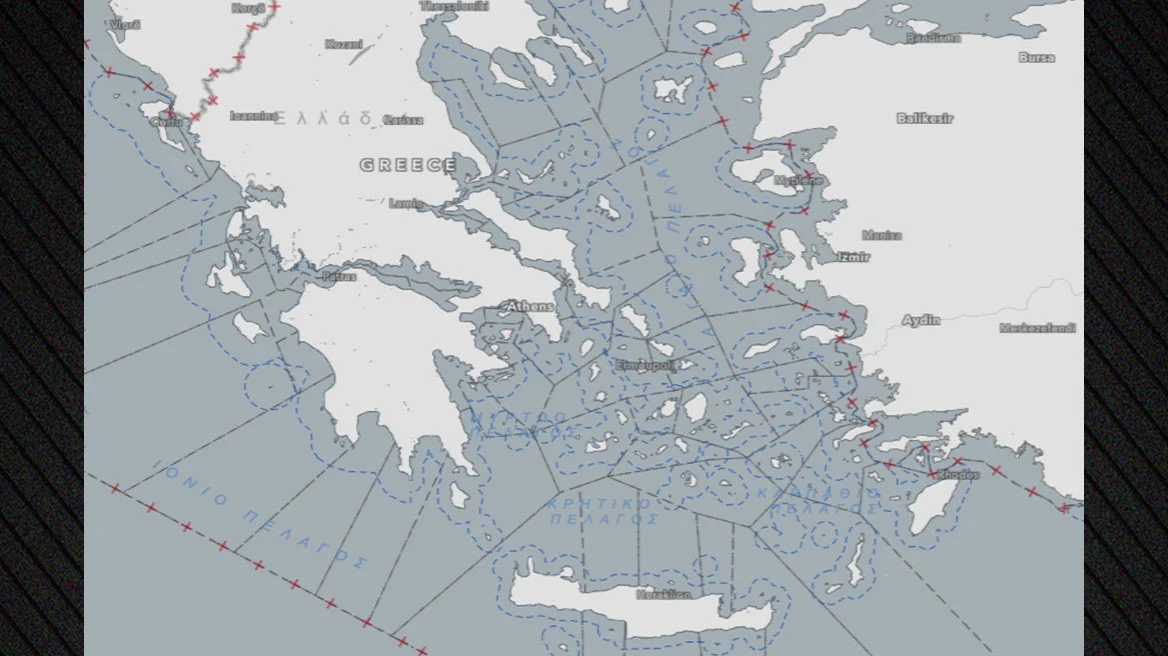
The maps published by the Greek Directorate of Fisheries Control, which introduce fishing restrictions for environmental reasons, have triggered a reaction from Turkey. In a statement, the Turkish Foreign Ministry said that “the maps, which draw imaginary maritime borders between Turkey and Greece in the Aegean and the Mediterranean and violate Turkey’s maritime jurisdiction in these areas, are invalid.”
This statement comes amid rising tensions caused by Ankara in recent days, following the Trilateral Cooperation between Greece, Cyprus, and Israel.
The Turkish Foreign Ministry also claims that Greece is imposing fishing restrictions in areas of the Aegean and Mediterranean where it has no jurisdiction, arguing that these measures violate international law. It makes specific reference to restrictions beyond 6 nautical miles and in international waters, which Turkey considers “invalid.”
In its statement, the Turkish Foreign Ministry adds that Turkey supports a “sincere approach to resolving issues based on international law, equality, and good neighborly relations,” within the framework of the Athens Declaration on Friendly Relations and Good Neighborliness of December 7, 2023.
Ankara refers to maps published on the Greek Directorate of Fisheries Control website, while today Special Environmental Studies (SES) 8A and 8B for Natura 2000 areas in the South Aegean were approved, paving the way for the completion of the legal framework for the South Aegean National Marine Park 1 – Southern Cyclades.
According to the Ministry of Environment and Energy, these new studies complete the required environmental framework for drafting the Presidential Decree. They also cover land areas of the largest islands included in the Natura 2000 network that had been pending, following the approval at the end of 2025 of the study for the marine part of the park.
Their approval contributes to the substantial protection of the Cyclades and parts of the Dodecanese, as well as to the comprehensive safeguarding of their unique natural environment. For the first time, a clear, coherent, and modern regulatory framework is being established for protected areas across the Cyclades, parts of the Dodecanese, and the islets Falkonera and Velopoula in the Myrtoan Sea. At the same time, the overall planning for the protection of the marine and island environment of the South Aegean is being strengthened.
It is recalled that since April 2025, Turkey has been raising tensions over Greece’s Maritime Spatial Planning, which defines permitted activities in marine areas in line with European legislation, as well as over the designation of two marine parks. Turkey had published its own maritime plan, which, however, systematically violated Greek sovereign rights.
Ask me anything
Explore related questions


